Fault Line III, from the series Fault Line, 2015
Medium: photography; silver gelatin print on resin-coated paper
Size: 40″ × 30″; Edition: 9 + 2AP
Fault Line IV, from the series Fault Line, 2015
Medium: photography; silver gelatin print on resin-coated paper
Size: 16″ × 12″; Edition: 12 + 2AP

Fault Line V, from the series Fault Line, 2015
Medium: photography; silver gelatin print on resin-coated paper
Size: 40″ × 30″; Edition: 9 + 2AP
Fault Line VI, from the series Fault Line, 2015
Medium: photography; silver gelatin print on resin-coated paper
Size: 40″ × 30″; Edition: 9 + 2AP
Fault Line VII, from the series Fault Line, 2015
Medium: photography; silver gelatin print on resin-coated paper
Size: 16″ × 12″; Edition: 12 + 2AP
Fault Line VIII, from the series Fault Line, 2015
Medium: photography; silver gelatin print on resin-coated paper
Size: 40″ × 30″; Edition: 9 + 2AP
Fault Line IX, from the series Fault Line, 2015
Medium: photography; silver gelatin print on resin-coated paper
Size: 40″ × 30″; Edition: 9 + 2AP

Fault Line X, from the series Fault Line, 2015
Medium: photography; silver gelatin print on resin-coated paper
Size: 40″ × 30″; Edition: 9 + 2AP

Fault Line XI, from the series Fault Line, 2015
Medium: photography; silver gelatin print on resin-coated paper
Size: 16″ × 12″; Edition: 12 + 2AP

Fault Line XII, from the series Fault Line, 2015
Medium: photography; silver gelatin print on resin-coated paper
Size: 40″ × 30″; Edition: 9 + 2AP
Fault Line XIII, from the series Fault Line, 2015
Medium: photography; silver gelatin print on resin-coated paper
Size: 16″ × 12″; Edition: 12 + 2AP
Fault Line XIV, from the series Fault Line, 2015
Medium: photography; silver gelatin print on resin-coated paper
Size: 16″ × 12″; Edition: 12 + 2AP
Fault Line XV, from the series Fault Line, 2015
Medium: photography; silver gelatin print on resin-coated paper
Size: 40″ × 30″; Edition: 9 + 2AP
Fault Line XVI, from the series Fault Line, 2015
Medium: photography; silver gelatin print on resin-coated paper
Size: 16″ × 12″; Edition: 12 + 2AP
Fault Line XVII, from the series Fault Line, 2015
Medium: photography; silver gelatin print on resin-coated paper
Size: 40″ × 30″; Edition: 9 + 2AP
Fault Line (2015)
Artist Statement
On the wall is a bathymetric map – a map of the topography of a section of the Pacific Ocean floor 2,500 miles east of Australia. Intricate black wrinkles spread across the map denoting the contours and pressure ridges of the ocean landscape. At a depth of 11 miles those contours coalesce to form a thick, dark crease across the map. At this spot the Pacific tectonic plate dives below the Australian plate at an average of 10 inches per year – by far the fastest plate movement on the planet.
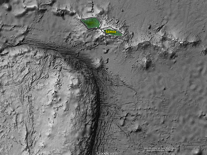
In 2009, in a massive fault rupture, the plates moved 22 feet relative to each other for a distance of 155 miles. The resulting wave was 55 feet high when it hit the nearest coastline – the island of Samoa, 100 miles to the north. It killed 189 people, destroyed 20 villages and left 3000 homeless.
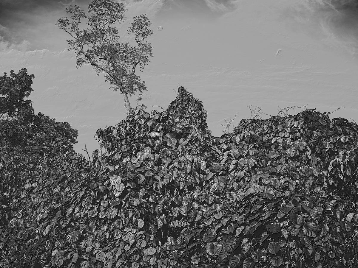
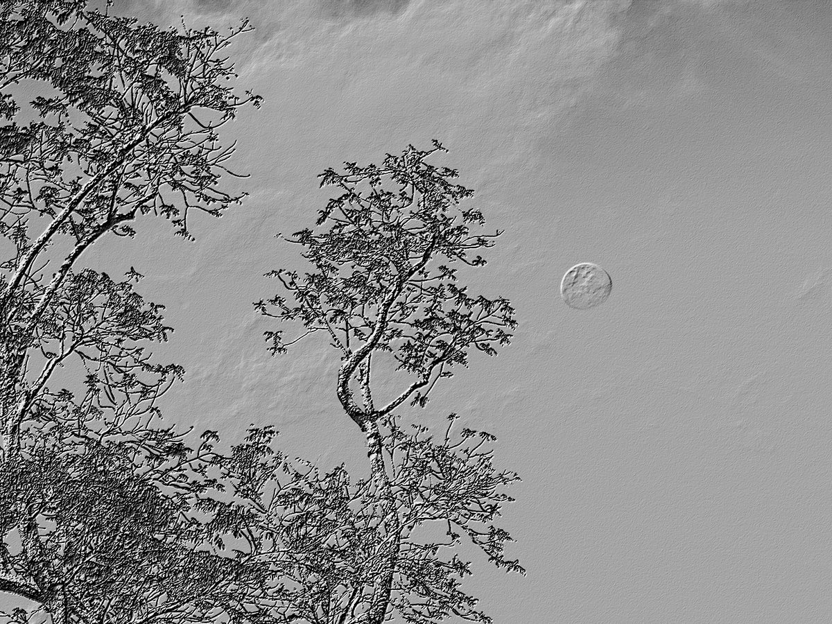
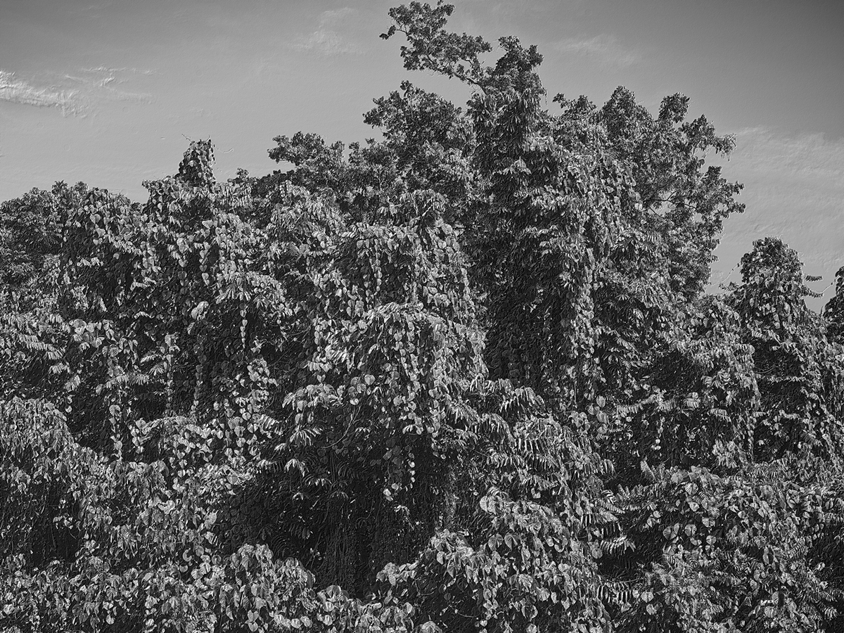
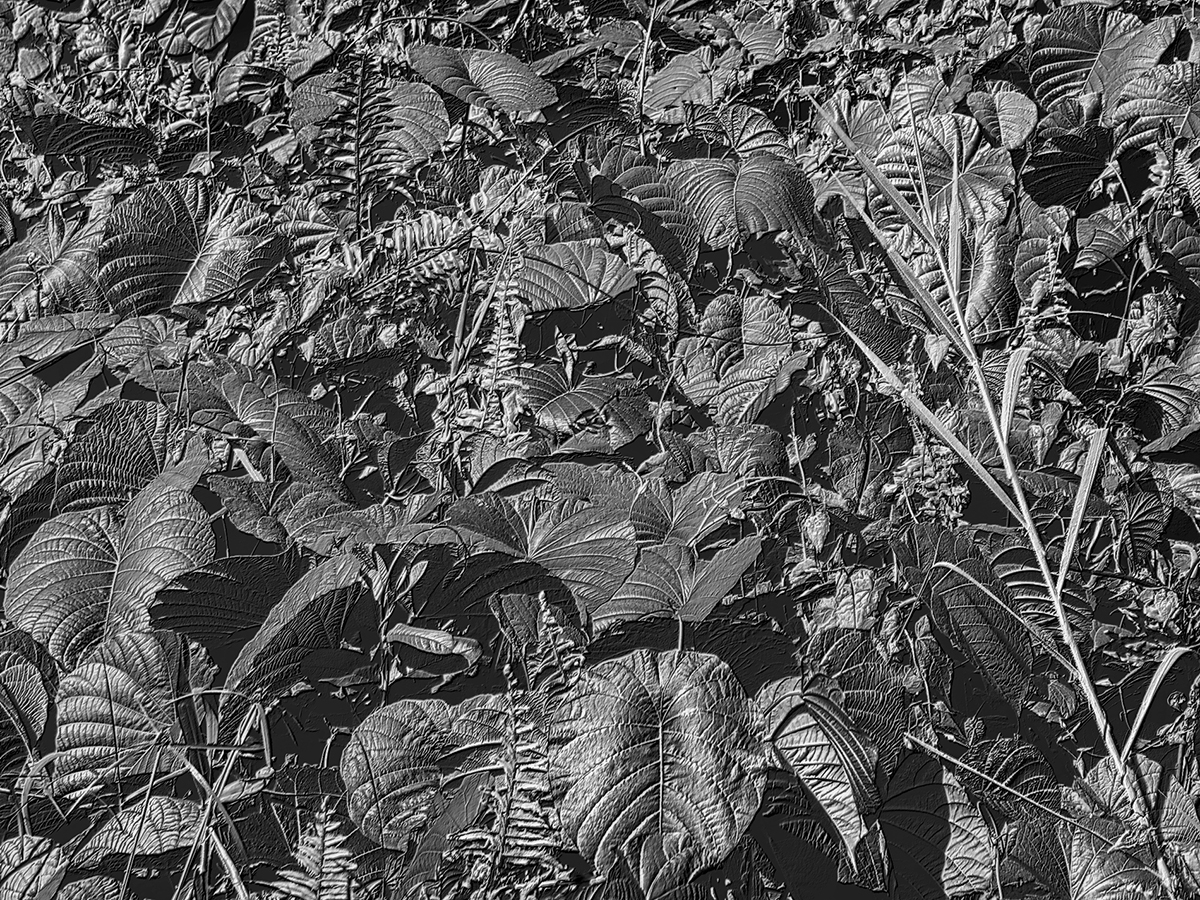
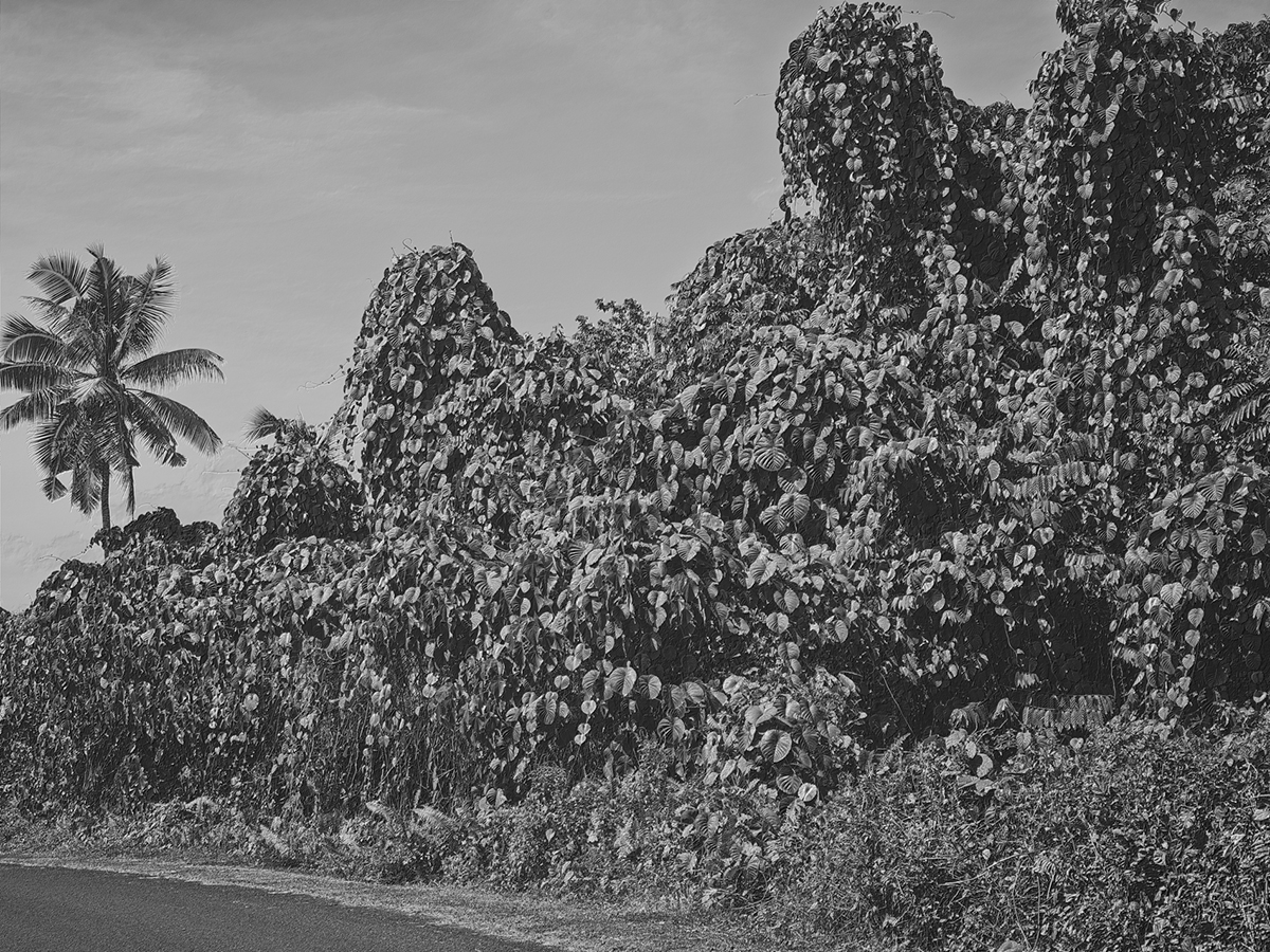
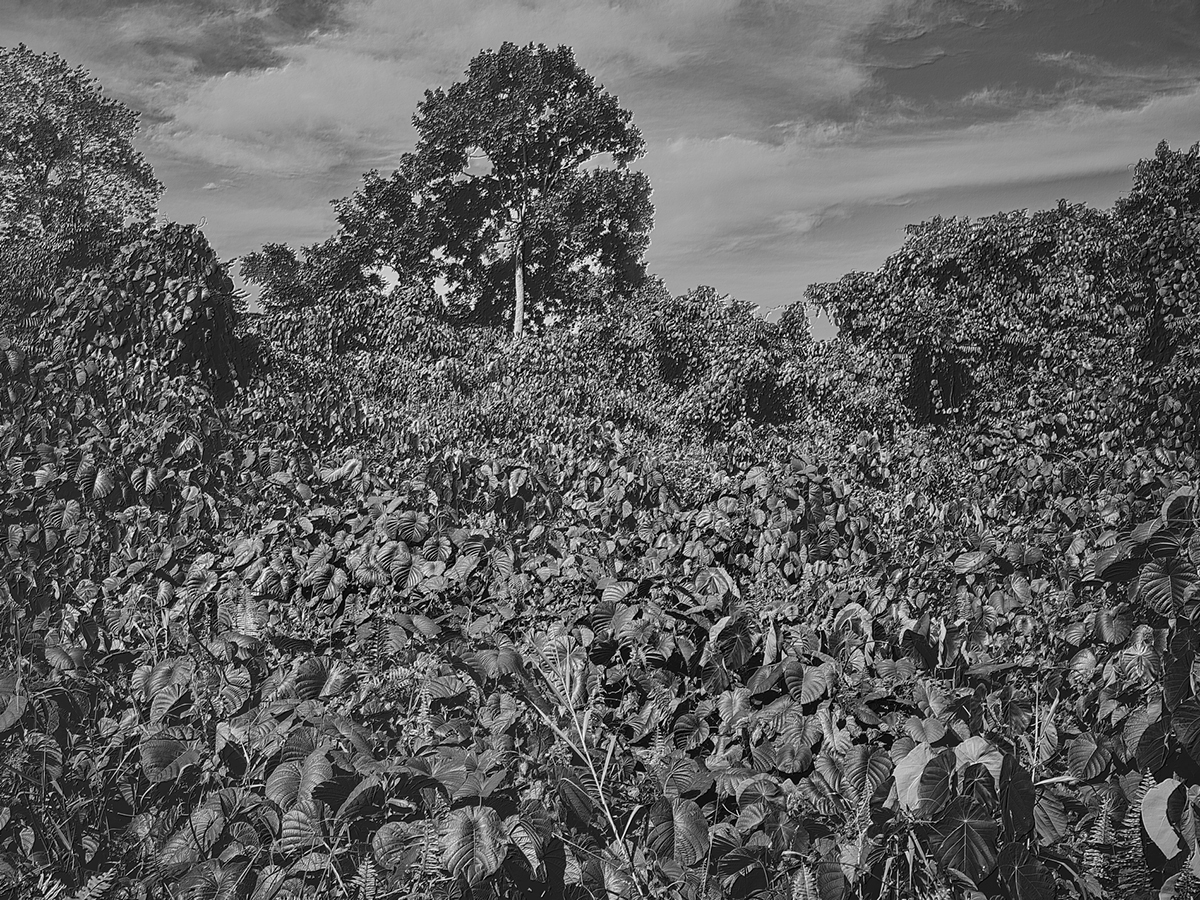
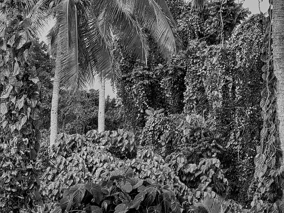
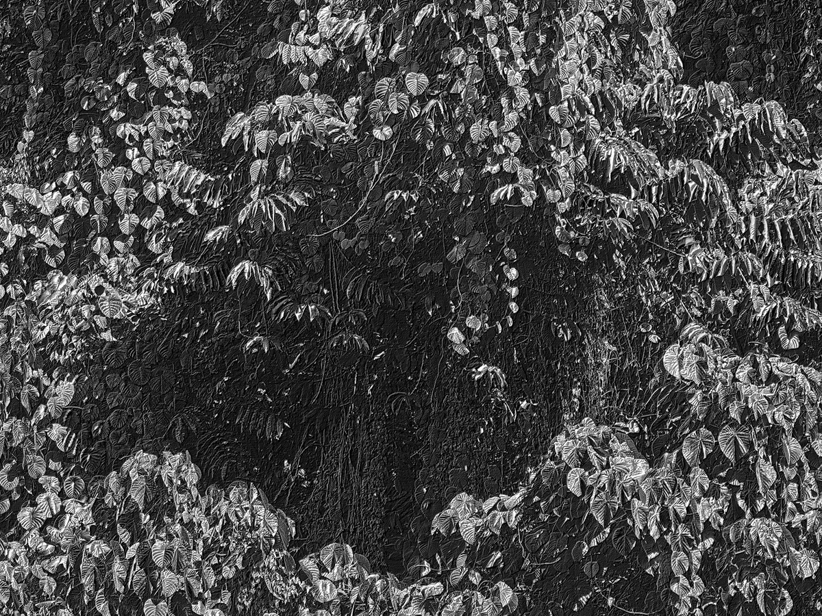
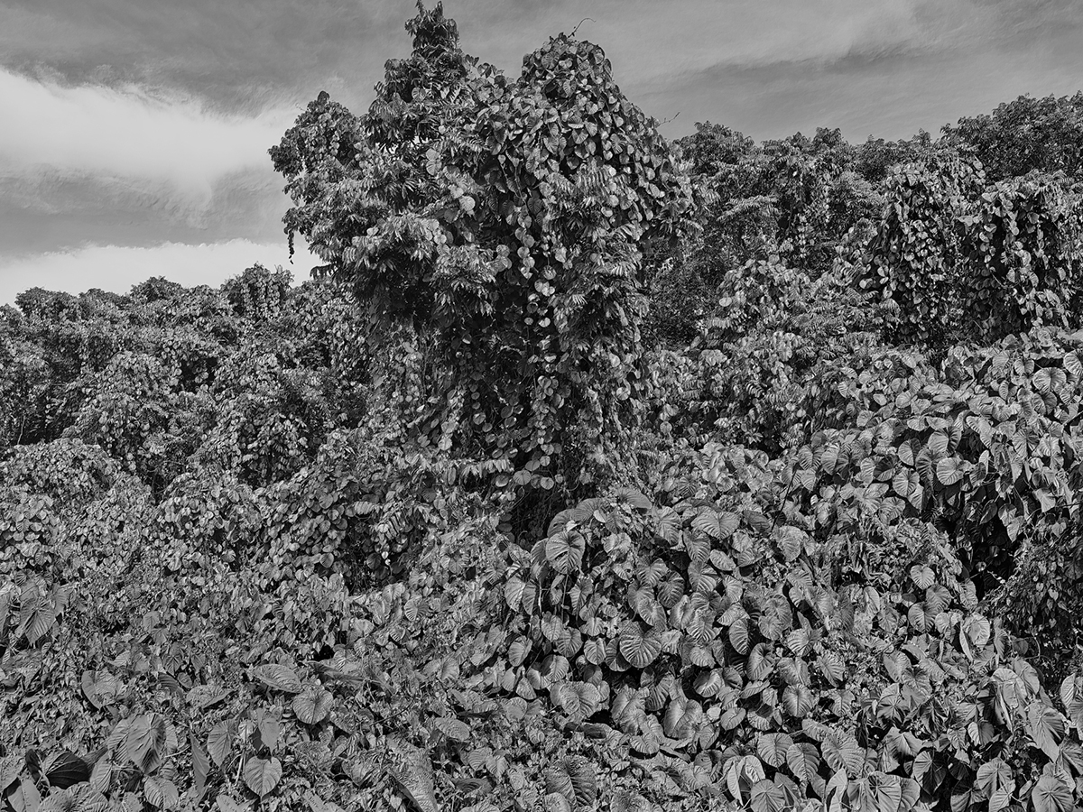
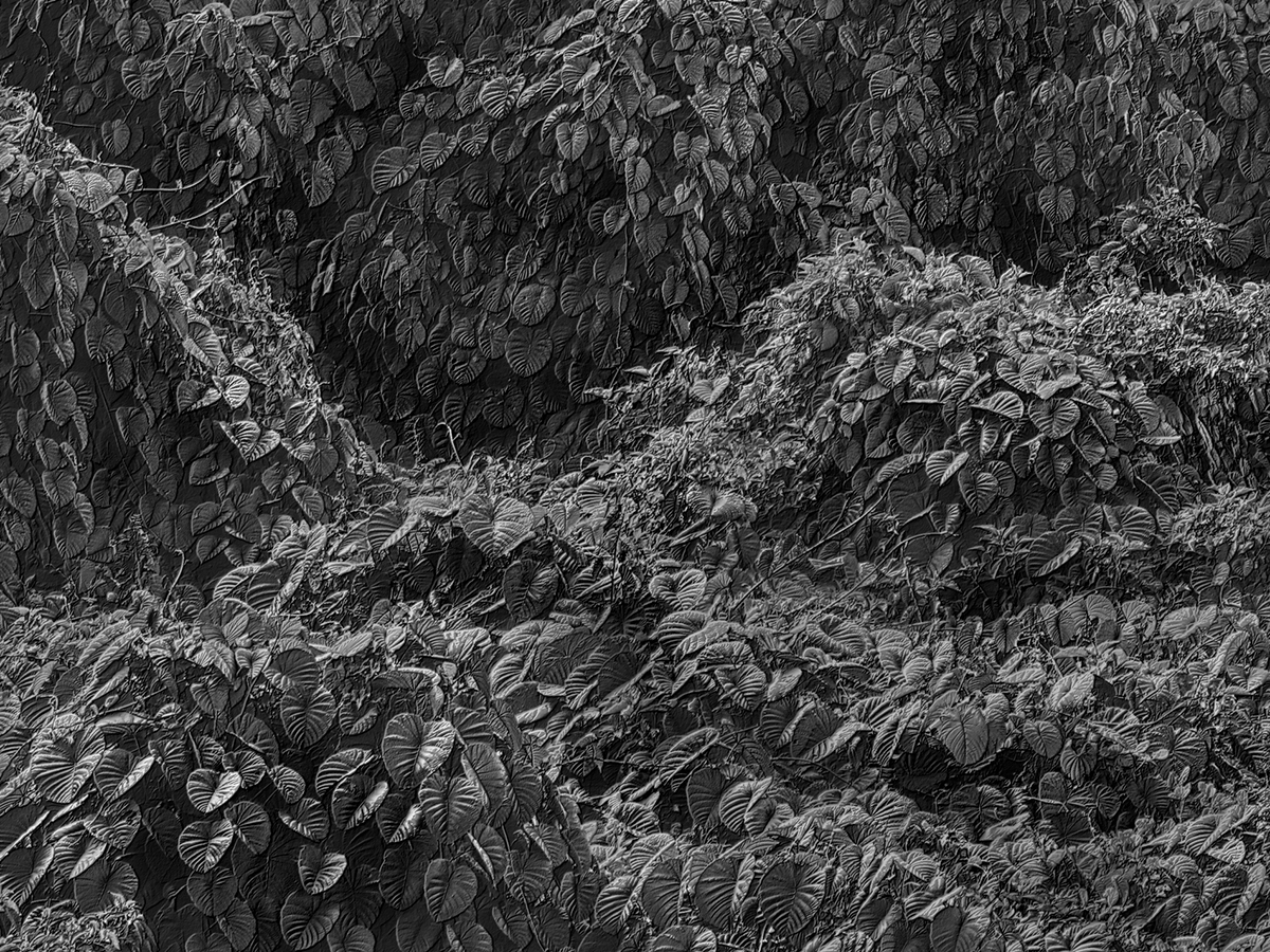
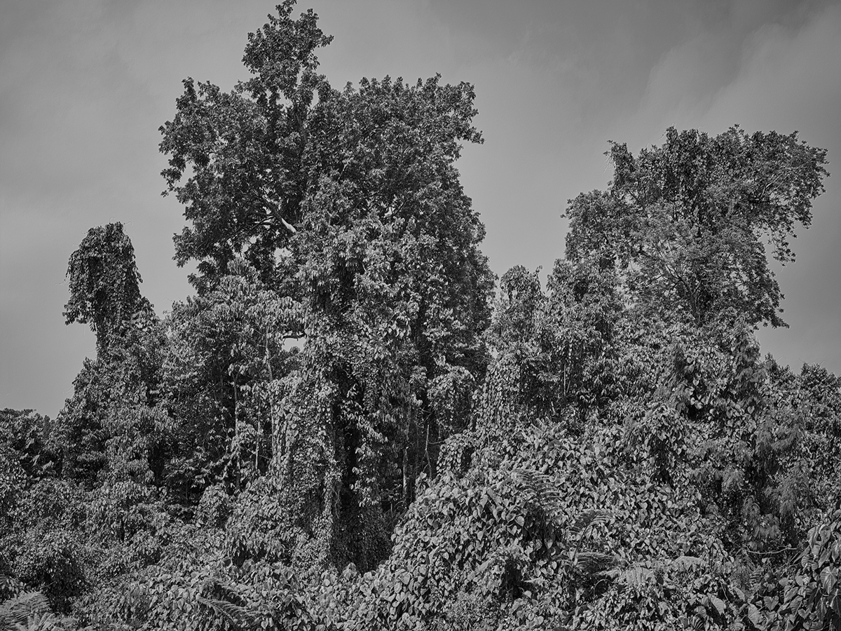
The visitor to present-day Samoa is immediately confronted by swathes of vegetation that rise, several storeys high, from the roadsides. Comprising one single species – Merremia Peltata – it engulfs everything in its path. This fast-growing invasive vine with broad, waxy leaves has smothered and killed more than 60% of Samoa’s native forest, the contours of the rising carpet of vines eerily emulating the topography of the fault line on the seafloor map. The vines surge over the landscape in the shape of a vast breaking wave, an inundation of vegetation and a striking echo of the tsunami.
Availability & Pricing
Prices start at $800 for the 16″ x 12″ and $1,950 for the 40″ x 30″, increasing as the edition sells.
Please contact the gallery for more information, including current availability and pricing.